Exhibition organized by the Collectivité de Corse
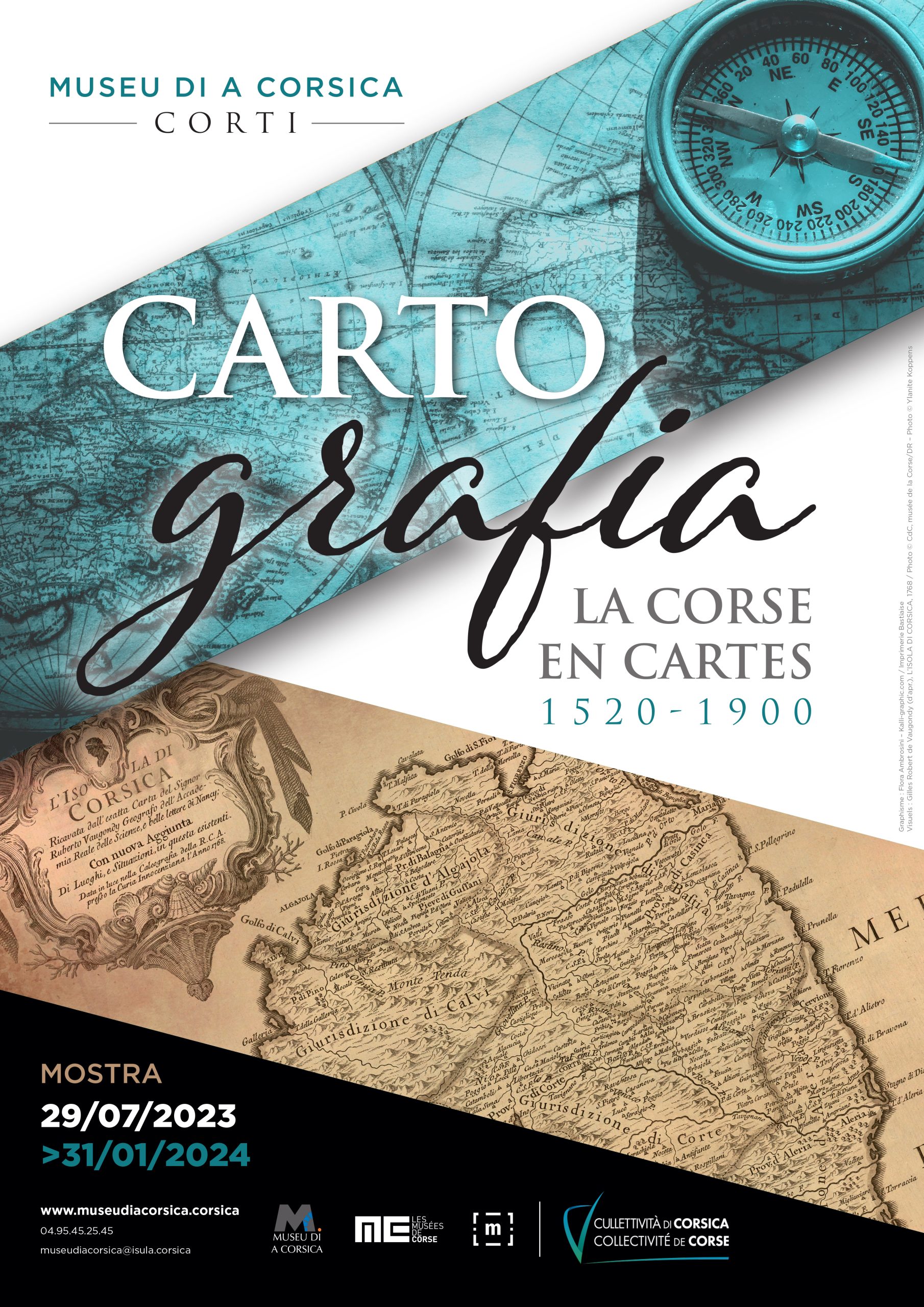
“The Museum of Corsica unveils its finest geographical maps”
CUMMISSARIATU È RISPUNSABILITÀ SCENTIFICA – COMMISSARIAT ET RESPONSABILITÉ SCIENTIFIQUE
Dominique Gresle, Historienne. Docteur en histoire et civilisations. EHESS. Paris.
CUNSIGLIERU SCENTIFICU – CONSEILLER SCIENTIFIQUE
Pierre Portet, Conservateur général honoraire du Patrimoine. Ancien directeur des archives de la Collectivité de Corse.
In 2023, the Museum of Corsica invites visitors on a journey to discover the world of maps. Combining history and geography, Cartografia, Corsica in Maps 1520-1900 explores representations of the island and the Mediterranean mapped out under the eye of cosmographers, politicians, soldiers and hydrographers.
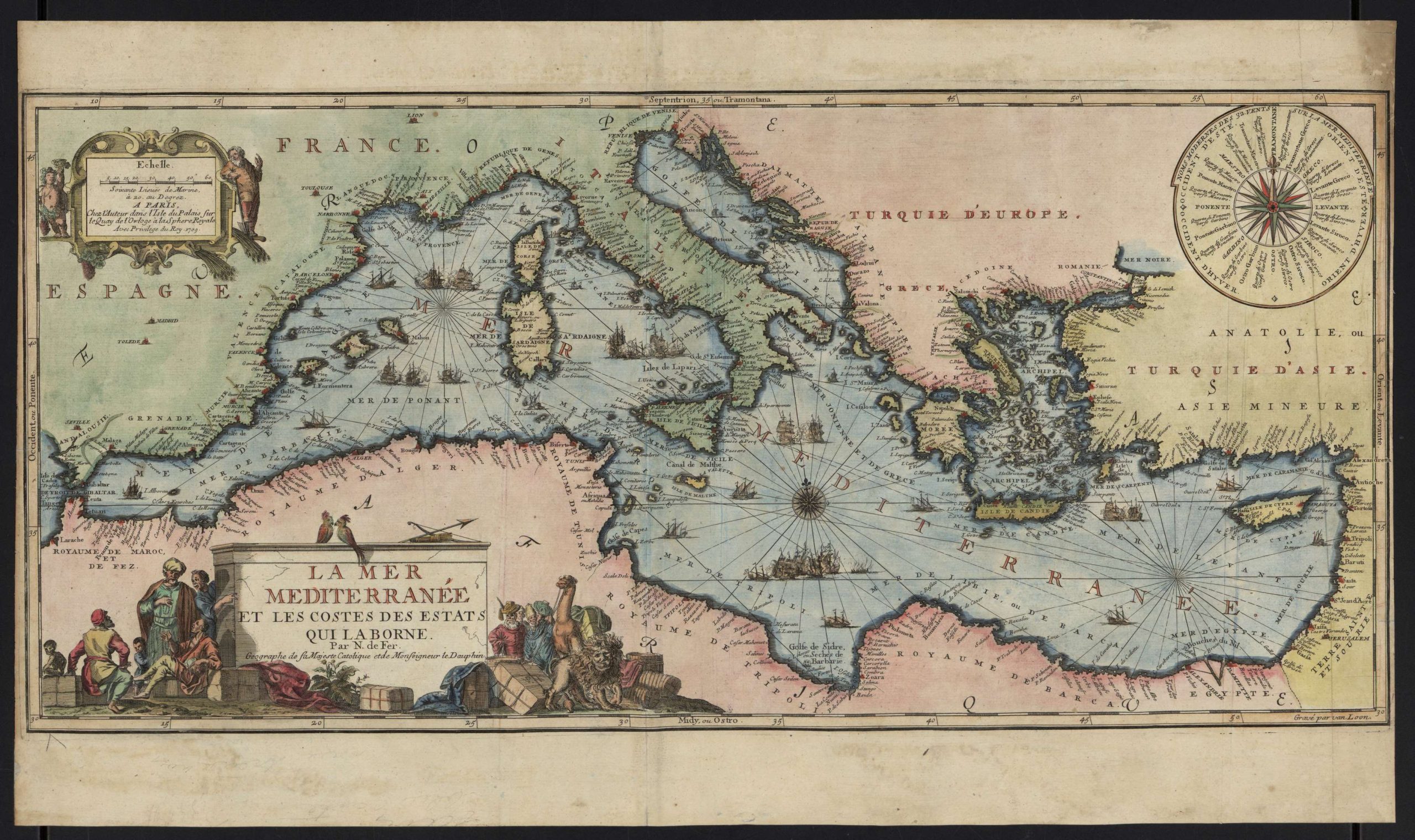
As well as presenting a selection of antique documents, maps, plans, books and atlases, the exhibition introduces visitors to the dramatis personae and the various instruments employed in the discipline of cartography.
The diversity of the exhibits on display – their forms, materials and colours – is highly informative. A whole new world opens up, with illustrations that record the keen interest shown in Corsica over several centuries.
The timeline of the exhibition stretches from 1520 to 1900 : four centuries of perspectives on the island of Corsica and its relationship to the wider world.
The exhibits selected from the Museum of Corsica’s collections are presented with a view to sharing a slice of the island’s heritage. The displays are enriched by loans from a range of Corsican, national and international institutions and private collections rarely shown to the public.
Cartografia, Corsica in Maps 1520-1900 also gives visitors the opportunity to delve into a long and invaluable figurative sequence in the history of the island.
The exhibition displays over 300 works organised into two main sequences and five distinct sections.
© CdC, musée de la Corse/DR
Two additional activities round off the visit.
“All about maps” : Exhibition for children (6-11 years old)
An interactive, fun-packed space where kids can find out about all aspects of cartography.
Children aged 6 to 11 are invited to delve into the history of cartography through games, an animated film and fun gadgets that they are encouraged to handle. They will learn to read a map and try out the cartographer’s tools before thinking about the relationship between maps and the imagination, poetry, fantasy literature and art.
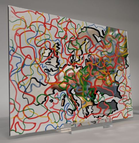
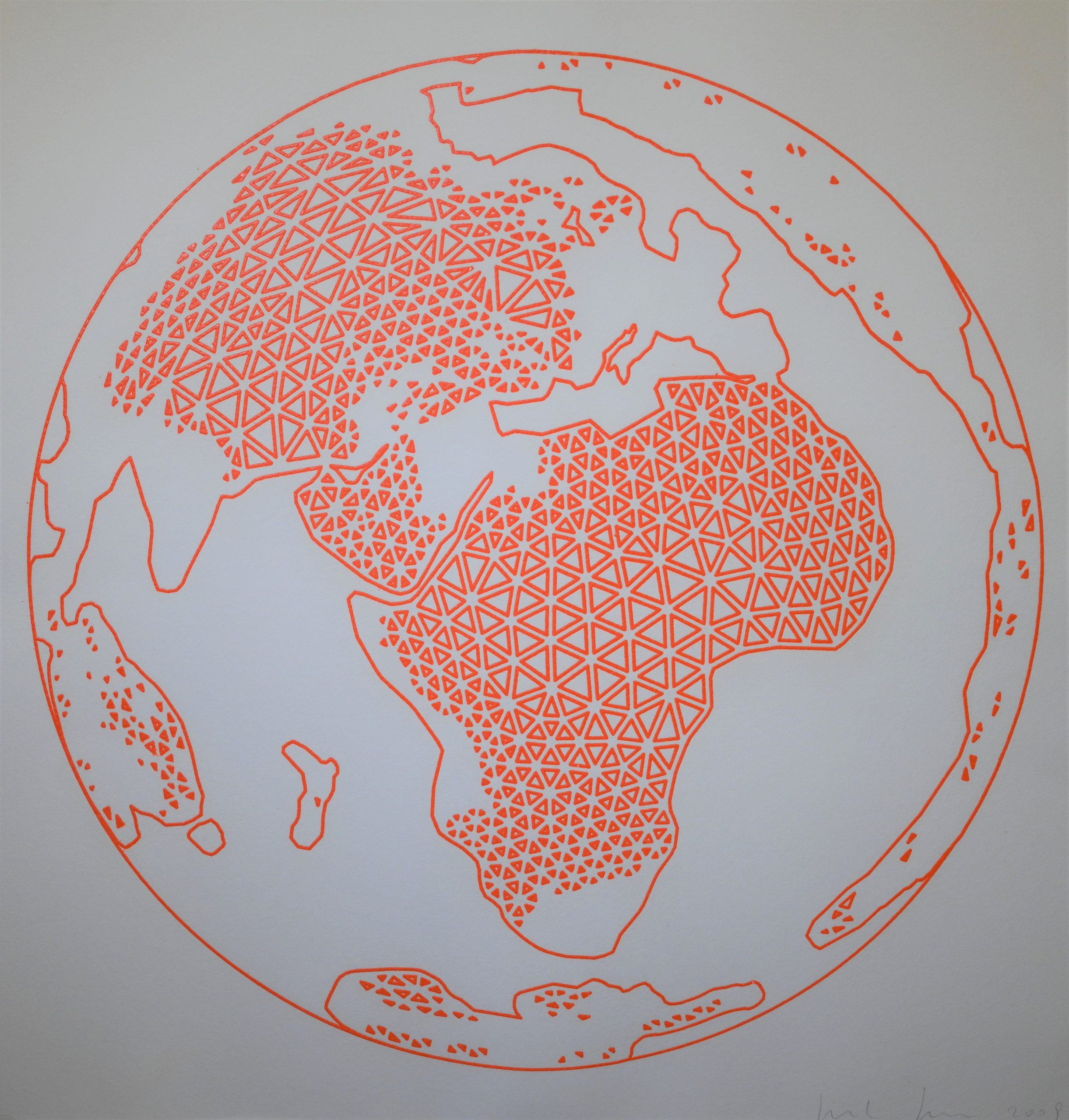
“MAP”. The use of maps in art since the 1960s : A Contemporary Perspective
This exhibition presents 15 works created by leading artists on the international scene andheld in public and private collections. It consists of a collection of historical oeuvres that are representative of conceptual and land art alongside more recent work.
The display can be found in one of the rooms housing the permanent collection, where it introduces visitors to work from the 1960s to the present day. These exhibits challenge the way artists have appropriated cartography in order to question the status of the work of art, how it is defined and even its materiality – and, more broadly, the relationship of man to the world.
The exhibition presents a selection of work held in public or private collections in France by leading international artists representing the key trends that have shaped the history of art over the last 50 years.
© CdC, direction du patrimoine/DR